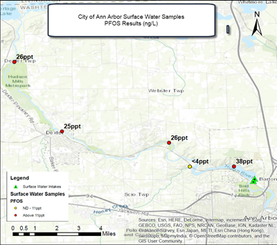
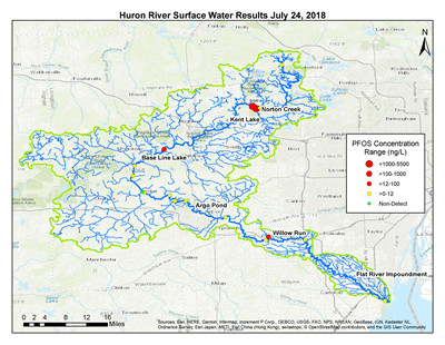
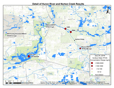
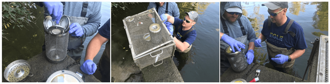
As of February 2026, the Michigan Department of Environment, Great Lakes, and Energy Fish Contaminant Monitoring Program has collected the following fish samples for edible portion monitoring from the Huron River or nearby water bodies. The fillets have been or will be analyzed for PFAS and other contaminants. The Michigan Department of Health and Human Services is evaluating the results for the "Eat Safe Fish" consumption advisories which are based on concentrations of mercury, PFOS, and other contaminants. Anglers should refer to the advice posted on the MPART PFAS in Fish webpage and the Michigan Eat Safe Fish webpage.
ND indicates that PFOS was not detected (<0.25 ppb) in the sample.
| Water Body |
Location |
Latitude |
Longitude |
Species |
Collection Year |
PFOS (ppb) Range |
| Huron River |
Pontiac Lake |
42.6692 |
-83.461 |
Largemouth Bass |
2022 |
5.3 - 13.6 |
| Huron River |
Pontiac Lake |
42.6692 |
-83.461 |
Bluegill |
2022 |
8.3 - 43.9 |
| Huron River |
Proud Lake |
42.56839 |
-83.52087 |
Bluegill |
2019 |
2.7 – 21.8 |
| Huron River |
Proud Lake |
42.56839 |
-83.52087 |
Pumpkinseed |
2021 |
10.1 – 46.7 |
| Huron River |
Proud Lake |
42.56839 |
-83.52087 |
Rock Bass |
2019 |
0.7 – 19.2 |
| Huron River |
Proud Lake |
42.56839 |
-83.52087 |
Largemouth/Smallmouth Bass |
2019 |
2.6 – 307.0 |
| Huron River |
Proud Lake |
42.56839 |
-83.52087 |
Largemouth/Smallmouth Bass |
2021 |
4.6 – 59.2 |
| Huron River |
Hubbell Pond |
42.58614 |
-83.6141 |
Largemouth Bass |
2018 | 516.0 – 1,408 |
| Huron River |
Kent Lake |
42.52957 |
-83.64402 |
Black Crappie |
2017 |
870 – 1,378 |
| Huron River |
Kent Lake |
42.52957 |
-83.64402 |
Black Crappie |
2025 |
Pending |
| Huron River |
Kent Lake |
42.52957 |
-83.64402 |
Pumpkinseed |
2019 |
18.6 – 184.0 |
| Huron River |
Kent Lake |
42.52957 |
-83.64402 |
Bluegill/Pumpkinseed |
2020 |
32.0 – 114.0 |
| Huron River |
Kent Lake |
42.52957 |
-83.64402 |
Pumpkinseed |
2021 |
17.6 – 73.4 |
| Huron River |
Kent Lake |
42.52957 |
-83.64402 |
Bluegill/Pumpkinseed |
2022 |
16.3 - 69.3 |
| Huron River |
Kent Lake |
42.52957 |
-83.64402 |
Bluegill/Pumpkinseed |
2023 |
5.4 - 44.5 |
| Huron River |
Kent Lake |
42.52957 |
-83.64402 |
Bluegill/Pumpkinseed |
2024 |
4.4 - 23.1 |
| Huron River |
Kent Lake |
42.52957 |
-83.64402 |
Bluegill/Pumpkinseed |
2025 |
Pending |
| Huron River |
Kent Lake |
42.52957 |
-83.64402 |
Rock Bass |
2021 |
80.3 - 387.0 |
| Huron River |
Kent Lake |
42.52957 |
-83.64402 |
Rock Bass |
2023 |
17.2 - 46.4 |
| Huron River |
Kent Lake |
42.52957 |
-83.64402 |
Rock Bass |
2024 |
9.4 - 76.8 |
| Huron River |
Kent Lake |
42.52957 |
-83.64402 |
Largemouth Bass |
2017 |
1,016 – 1,998 |
| Huron River |
Kent Lake |
42.52957 |
-83.64402 |
Largemouth Bass |
2019 |
167.0 – 441.0 |
| Huron River |
Kent Lake |
42.52957 |
-83.64402 |
Largemouth Bass |
2020 |
301.0 – 500.0 |
| Huron River |
Kent Lake |
42.52957 |
-83.64402 |
Largemouth Bass |
2021 |
73.7 – 444.6 |
| Huron River |
Kent Lake |
42.52957 |
-83.64402 |
Largemouth Bass |
2022 |
47.5 - 225.6 |
| Huron River |
Kent Lake |
42.52957 |
-83.64402 |
Largemouth Bass |
2023 |
60.4 - 196.1 |
| Huron River |
Kent Lake |
42.52957 |
-83.64402 |
Largemouth Bass |
2024 |
8.0 - 75.0 |
| Huron River |
Kent Lake |
42.52957 |
-83.64402 |
Largemouth Bass |
2025 |
Pending |
| Huron River |
Strawberry Lake |
42.44362 |
-83.84011 |
Bluegill |
2022 |
10.5 - 18.9 |
| Huron River |
Strawberry Lake |
42.44362 |
-83.84011 |
Largemouth Bass |
2022 |
30.5 - 74.7 |
| Huron River |
Loon Lake |
42.43650 |
-83.86210 |
Bluegill |
2025 |
Pending |
| Huron River |
Base Line Lake |
42.42779 |
-83.89471 |
Bluegill |
2018 |
56.3 – 162.4 |
| Huron River |
Base Line Lake |
42.42779 |
-83.89471 |
Bluegill |
2020 |
14.1 – 66.3 |
| Huron River |
Base Line Lake |
42.42779 |
-83.89471 |
Bluegill/Pumpkinseed |
2022 |
4.1 - 18.4 |
| Huron River |
Base Line Lake |
42.42779 |
-83.89471 |
Rock Bass |
2020 |
ND – 76.7 |
| Huron River |
Base Line Lake |
42.42779 |
-83.89471 |
Rock Bass |
2022 |
5.2 - 24.8 |
| Huron River |
Base Line Lake |
42.42779 |
-83.89471 |
Largemouth Bass |
2018 |
73.2 – 366.3 |
| Huron River |
Base Line Lake |
42.42779 |
-83.89471 |
Largemouth Bass |
2020 |
45.7 – 187.0 |
| Huron River |
Base Line Lake |
42.42779 |
-83.89471 |
Largemouth Bass |
2022 |
14.1 - 47.9 |
| Huron River |
Barton Pond |
42.31332 |
-83.78766 |
Bluegill/Pumpkinseed |
2018 |
8.7 – 19.9 |
| Huron River |
Barton Pond |
42.31332 |
-83.78766 |
Bluegill/Pumpkinseed |
2022 |
3.9 - 10.0 |
| Huron River |
Argo Pond |
42.29262 |
-83.74523 |
Rock Bass |
2015 |
102.3 – 487.5 |
| Huron River |
Argo Pond |
42.29262 |
-83.74523 |
Rock Bass |
2018 |
13.5 – 60.9 |
| Huron River |
Argo Pond |
42.29262 |
-83.74523 |
Rock Bass |
2020 |
ND – 25.2 |
| Huron River |
Argo Pond |
42.29262 |
-83.74523 |
Bluegill |
2018 |
ND – 23.6 |
| Huron River |
Argo Pond |
42.29262 |
-83.74523 |
Bluegill |
2020 |
10.1 – 51.7 |
| Huron River |
Argo Pond |
42.29262 |
-83.74523 |
Largemouth/Smallmouth Bass |
2018 |
20.6 – 64.7 |
| Huron River |
Argo Pond |
42.29262 |
-83.74523 |
Largemouth/Smallmouth Bass |
2020 |
27.7 – 64.2 |
| Huron River |
Ford Lake |
42.21696 |
-83.58466 |
Largemouth/Smallmouth Bass |
2020 |
12.8 – 92.6 |
| Huron River |
Ford Lake |
42.21696 |
-83.58466 |
Smallmouth Bass |
2021 |
20.6 – 108.0 |
| Huron River |
Ford Lake |
42.21696 |
-83.58466 |
Bluegill/Pumpkinseed |
2020 |
11.0 – 75.5 |
| Huron River |
Ford Lake |
42.21696 |
-83.58466 |
Bluegill |
2021 |
28.2 – 64.6 |
| Huron River |
Ford Lake |
42.21696 |
-83.58466 |
Rock Bass |
2020 |
22.6 – 53.3 |
| Huron River |
Ford Lake |
42.21696 |
-83.58466 |
Rock Bass |
2021 |
22.2 – 105.0 |
| Huron River |
Ford Lake |
42.21696 |
-83.58466 |
Walleye |
2021 |
18.7 – 41.4 |
| Huron River |
Ford Lake |
42.21696 |
-83.58466 |
Walleye |
2023 |
14.6 - 43.2 |
| Huron River |
Ford Lake |
42.21696 |
-83.58466 |
Carp |
2023 |
8.5 - 22.8 |
| Huron River |
Belleville Lake |
42.21447 |
-83.47022 |
Bluegill |
2018 |
2.2 – 41.3 |
| Huron River |
Belleville Lake |
42.21447 |
-83.47022 |
Bluegill |
2021 |
18.6 – 35.3 |
| Huron River |
Belleville Lake |
42.21447 |
-83.47022 |
Rock Bass |
2021 |
63.1 – 164 |
| Huron River |
Belleville Lake |
42.21447 |
-83.47022 |
Rock Bass |
2022 |
3.9 - 11.9 |
| Huron River |
Belleville Lake |
42.21447 |
-83.47022 |
Smallmouth Bass |
2018 |
27.5 – 89.0 |
| Huron River |
Belleville Lake |
42.21447 |
-83.47022 |
Smallmouth Bass |
2021 |
16.7 – 66.8 |
| Huron River |
Belleville Lake |
42.21447 |
-83.47022 |
Walleye |
2021 |
21.1 – 40.5 |
| Huron River |
Belleville Lake |
42.21447 |
-83.47022 |
Walleye |
2022 |
19.9 - 58.6 |
| Huron River |
Flat Rock |
42.10459 |
-83.30521 |
Channel Catfish |
2017 |
2.0 – 22.2 |
| Huron River |
Flat Rock |
42.10459 |
-83.30521 |
Black Crappie |
2018 |
ND – 27.6 |
| Huron River |
Flat Rock |
42.10459 |
-83.30521 |
Largemouth Bass |
2018 |
9.6 – 26.7 |
| Huron River |
Flat Rock |
42.10459 |
-83.30521 |
Largemouth Bass |
2020 |
7.5 – 22.8 |
| Huron River |
Flat Rock |
42.10459 |
-83.30521 |
Bluegill |
2018 |
7.7 – 24.7 |
| Huron River |
Flat Rock |
42.10459 |
-83.30521 |
Bluegill/Pumpkinseed |
2020 |
ND – 25.7 |
| Huron River |
Rockwood |
42.06865 |
-83.25482 |
Largemouth Bass |
2021 |
16.1 – 55.5 |
| Huron River |
Rockwood |
42.06865 |
-83.25482 |
Bluegill |
2021 |
8.5 – 43.3 |
| Huron River |
Rockwood |
42.06865 |
-83.25482 |
Carp |
2021 |
4.6 – 12.5 |
| Huron River |
Pointe Mouillee |
42.04257 |
-83.21407 |
Bluegill/Pumpkinseed |
2025 |
Pending |
| Huron River |
Pointe Mouillee |
42.04257 |
-83.21407 |
Rock Bass |
2025 |
Pending |
| Huron River |
Pointe Mouillee |
42.04257 |
-83.21407 |
Largemouth Bass |
2025 |
Pending |
| Lake Erie |
Huron River, Flat Rock |
42.10459 |
-83.30521 |
Rainbow Trout (Steelhead) |
2019 |
1.7 – 4.8 |
| Pettibone Creek |
Milford Pond |
42.59023 |
-83.60261 |
Bluegill |
2018 |
ND – 4.8 |
| Wolverine Lake |
Commerce Charter Township |
42.55447 |
-83.49057 |
Bluegill |
2024 |
1.3 - 5.4 |
| Wolverine Lake |
Commerce Charter Township |
42.55447 |
-83.49057 |
Black Crappie |
2024 |
5.9 - 12.7 |
| Wolverine Lake |
Commerce Charter Township |
42.55447 |
-83.49057 |
Largemouth Bass |
2024 |
3.1 - 13.6 |
| Middle Straits Lake |
Commerce Charter Township |
42.58027 |
-83.43124 |
Bluegill |
2025 |
Pending |
| Middle Straits Lake |
Commerce Charter Township |
42.58027 |
-83.43124 |
Largemouth Bass |
2025 |
Pending |
| Lower Straits Lake |
Commerce Charter Township |
42.58255 |
-83.45974 |
Bluegill |
2025 |
Pending |
| Lower Straits Lake |
Commerce Charter Township |
42.58255 |
-83.45974 |
Yellow Perch |
2025 |
Pending |
| Lower Straits Lake |
Commerce Charter Township |
42.58255 |
-83.45974 |
Largemouth Bass |
2025 |
Pending |
| Loon Lake |
N of Wixom |
42.54811 |
-83.52908 |
Bluegill |
2022 |
62.7 - 188.6 |
| Bruin Lake |
Pinckney Rec Area |
42.41948 |
-84.03837 |
Bluegill/Pumpkinseed |
2021 |
4.8 – 30.3 |
| Portage River |
Little Portage Lake |
42.41482 |
-83.93067 |
Bluegill/Pumpkinseed |
2024 |
ND - 1.2 |
| Portage River |
Little Portage Lake |
42.41482 |
-83.93067 |
Black Crappie |
2024 |
2.0 - 4.3 |
| Portage River |
Little Portage Lake |
42.41482 |
-83.93067 |
Largemouth Bass |
2024 |
1.4 - 4.1 |
| Portage River |
Big Portage Lake |
42.42177 |
-83.91758 |
Bluegill |
2018 |
5.0 - 138.0 |
| Portage River |
Big Portage Lake |
42.42177 |
-83.91758 |
Bluegill/Pumpkinseed |
2022 |
0.4 - 6.9 |
| Portage River |
Big Portage Lake |
42.42177 |
-83.91758 |
Bluegill
|
2025 |
Pending |
| Portage River |
Big Portage Lake |
42.42177 |
-83.91758 |
Rock Bass |
2022 |
0.8 - 3.4 |
| Portage River |
Big Portage Lake |
42.42177 |
-83.91758 |
Largemouth Bass |
2018 |
6.6 - 173.8 |
| Portage River |
Big Portage Lake |
42.42177 |
-83.91758 |
Largemouth Bass |
2022 |
2.2 - 13.5 |
| Mann Creek |
Moraine Lake |
42.55914 |
-83.7171 |
Black Crappie |
2018 |
2.9 – 9.7 |
| Mann Creek |
Moraine Lake |
42.55914 |
-83.7171 |
Bluegill |
2018 |
ND – 14.8 |
| Mann Creek |
Moraine Lake |
42.55914 |
-83.7171 |
Largemouth/Smallmouth Bass |
2018 |
4.1 – 10.8 |
| Davis Creek |
Sandy Bottom Lake |
42.45203 |
-83.71462 |
Bluegill/Pumpkinseed |
2019 |
1.4 – 16.9 |
| Davis Creek |
Sandy Bottom Lake |
42.45203 |
-83.71462 |
Largemouth Bass |
2019 |
ND – 75.4 |
| Davis Creek |
Fish Lake |
42.45534 |
-83.72316 |
Bluegill |
2021 |
1.3 – 4.9 |
| South Ore Creek |
Woodland Lake |
42.55445 |
-83.78155 |
Bluegill/Pumpkinseed |
2019 |
1.1 – 5.6 |
| South Ore Creek |
Woodland Lake |
42.55445 |
-83.78155 |
Largemouth Bass |
2019 |
3.5 – 18.5 |
| South Ore Creek |
Brighton Mill Pond |
42.53218 |
-83.7839 |
Black Bullhead |
2023 |
ND |
| South Ore Creek |
Brighton Mill Pond |
42.53218 |
-83.7839 |
Black Crappie |
2023 |
8.7 - 16.7 |
| South Ore Creek |
Brighton Mill Pond |
42.53218 |
-83.7839 |
Bluegill |
2023 |
2.1 - 6.6 |
| South Ore Creek |
Ore Lake |
42.80951 |
-83.79536 |
Bluegill |
2019 |
4.9 – 20.0 |
| South Ore Creek |
Ore Lake |
42.80951 |
-83.79536 |
Bluegill/Pumpkinseed |
2023 |
4.8 - 20.9 |
| South Ore Creek |
Ore Lake |
42.80951 |
-83.79536 |
Largemouth Bass |
2023 |
14.8 - 25.3 |
| Little Ore Lake |
Little Ore Lake |
42.47489 |
-83.79749 |
Bluegill/Pumpkinseed |
2023 |
4.2 - 10.0 |
| Little Ore Lake |
Little Ore Lake |
42.47489 |
-83.79749 |
Largemouth Bass |
2023 |
13.2 - 51.9 |
| Horseshoe Creek |
Horseshoe Lake |
42.40056 |
-83.75714 |
Bluegill |
2024 |
2.5 - 7.9 |
| Horseshoe Creek |
Horseshoe Lake |
42.40056 |
-83.75714 |
Black Crappie |
2024 |
2.1 - 5.3 |
| Horseshoe Creek |
Horseshoe Lake |
42.40056 |
-83.75714 |
Largemouth Bass |
2024 |
3.5 - 7.2 |
| Whitmore Lake |
Livingston County |
42.4287 |
-83.75379 |
Bluegill/Pumpkinseed |
2019 |
2.0 – 4.6 |
| Hay Creek |
Bass Lake |
42.45425 |
-83.86102 |
Bluegill |
2019 |
1.7 – 9.3 |
| Hay Creek |
Bass Lake |
42.45425 |
-83.86102 |
Largemouth Bass |
2019 |
ND – 14.4 |
| Silver Lake |
w. of Portage Lake |
42.42113 |
-83.96666 |
Bluegill |
2020 |
ND |
| Spring Mill Pond |
Island Lake Rec Area |
42.48939 |
-83.72425 |
Bluegill |
2024 |
0.9 - 1.7 |
| Trout Lake |
Island Lake Rec Area |
42.50506 |
-83.68470 |
Bluegill |
2026 |
Pending |
| Regan Drain |
Washago Pond |
42.1304 |
-83.3729 |
Pumpkinseed |
2020 |
ND – 110.0 |
| Joslin Lake |
s.e. of Stockbridge |
42.41876 |
-84.07050 |
Bluegill |
2019 |
1.0 – 13.0 |
| Joslin Lake |
s.e. of Stockbridge |
42.41876 |
-84.07050 |
Largemouth Bass |
2019 |
1.4 – 27.7 |
| Long Lake |
w. of Pontiac |
42.61073 |
-83.45627 |
Bluegill |
2019 |
1.6 – 7.8 |
| Long Lake |
w. of Pontiac |
42.61073 |
-83.45627 |
Largemouth Bass |
2019 |
ND – 9.9 |
| Tamarack Lake |
Hamburg Township |
42.43293 |
-83.88675 |
Bluegill |
2024 |
6.0 - 21 |
| Tamarack Lake |
Hamburg Township |
42.43293 |
-83.88675 |
Largemouth Bass |
2024 |
22.9 - 35.8 |