The web Browser you are currently using is unsupported, and some features of this site may not work as intended. Please update to a modern browser such as Chrome, Firefox or Edge to experience all features Michigan.gov has to offer.
Groundwater: Out of sight, top of mind
March 07, 2023
Today’s MI Environment story is part of National Groundwater Awareness Week and is from the most recent State of the Great Lakes report.
When Great Lakes water levels swelled to record highs in 2019-20, so did most of Michigan’s groundwater tables, leading to inland flooding. But at the same time, other groundwater levels, especially in southwest Michigan, measured low. Resource managers were puzzled by what was happening with Michigan’s precious underground water reserves.

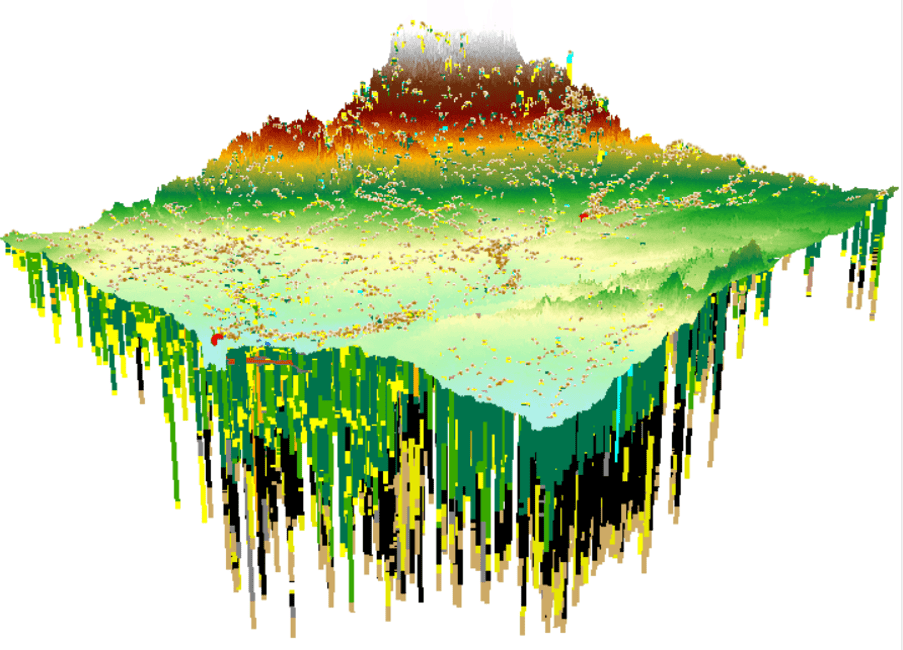
Three-dimensional rendering showing data from more than 8,000 water wells. It is vertically exaggerated 100 times to show the subsurface geology of Gladwin County.
It takes quality groundwater data to solve such mysteries. That’s something the Michigan Department of Environment, Great Lakes, and Energy (EGLE) has in abundance, but much of it has not been easily accessible to all EGLE staff, regulated parties, consultants, researchers, and the public. In addition, there are different data standards for quality and format across EGLE programs.
As part of a Lean Process Improvement (LPI) project, EGLE staff are working to create a centralized, searchable database for groundwater data including well construction logs, soil boring logs, location and elevation data, water quality samples, aquifer properties, geologic unit descriptions, and more.
This Groundwater Data Warehouse is expected to enable more-informed decision making, improve data quality, and increase transparency and confidence in EGLE data and decisions. The database will receive data directly from external parties and EGLE staff. It also will be linked to other EGLE databases and the Geographic Information System (GIS). An easily accessible format will allow for comparisons among datasets, resulting in greater confidence in decision making. Links also will allow transfer of data to existing data sources within Michigan and external databases in other governmental agencies, such as the U.S. Environmental Protection Agency (EPA) or U.S. Geological Survey (USGS).
Four teams are developing implementation plans and schedules for achieving the project’s goals:
- An external research team to identify best practices and whether existing data storage systems might be adapted for EGLE’s use.
- A standardization team to develop requirements for submitting different types of data and the use of electronic data deliverables.
- A structure team to research EGLE’s current data management and oversee development of the database structure.
- An outreach team to develop training materials and engage with regulated parties, consultants, researchers, governmental agencies, and other interested parties about how they can access and contribute data.
Better access to information will improve understanding of groundwater science in Michigan and the region and make decisions about water use more transparent – along with raising awareness about the importance of good stewardship.
New groundwater information will be the first data to populate the warehouse and follow the new standards. Existing groundwater data will then be retrofitted into the warehouse, which will be expandable in future phases to include not only groundwater information but interrelated data from all environmental media, such as soils data and stream data.
While implementation is just getting started, this is an exciting opportunity to create a system that has consistent data standards, is integrated, and improves access for users. The goal is to improve data inventory so it can be better used to support resource management decisions to protect the environment and align with a long-term data management plan. The centralization of data in a warehouse that both stores and retrieves data will also allow for greater internal efficiency. Look for an update in the 2023 State of the Great Lakes Report.