The Water Resources Division of the Michigan Department of Environment, Great Lakes, and Energy (EGLE) recently launched a dashboard on Michigan Lake Water Clarity.
The Michigan Lake Water Clarity Dashboard offers satellite-derived insights into lake clarity, algal biomass, and lake color—key indicators of inland lake water quality. Using remote sensing technology, data were collected from 2018 to 2023 from over 6,000 inland lakes larger than 20 surface acres. Using remotely sensed data provides information over six years on a large number of lakes, providing a new look at lake productivity across the state.
Explore the dashboard
Tips for using the dashboard
These water quality metrics are essential for understanding ecological conditions such as algal bloom risk, aquatic habitat, and can help understand lake health trends.
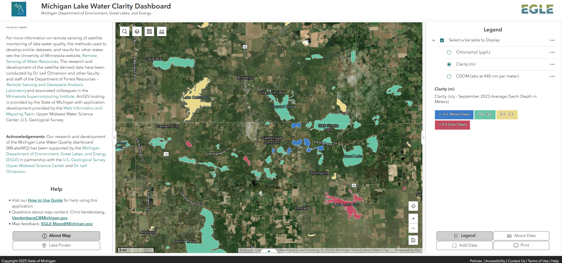
Developed in ArcGIS Online®, the dashboard features a user-friendly, interactive map that allows users to explore:
- Lake clarity (measured as Secchi disk depth in meters).
- Algal biomass (estimated via chlorophyll concentrations in µg/L).
- Lake color (represented by colored dissolved organic matter or CDOM, measured in absorbance at 440 nm).
The map displays 2023 late summer averages (July–September) for these parameters, with additional monthly data available when a lake is selected. The map also includes land cover statistics for a 1,000-meter buffer zone around each lake, offering context on surrounding environmental conditions.
To help users make the most of this new tool, EGLE has released a How to Use Guide, providing step-by-step instructions and tips for navigating the dashboard effectively.